Please use this identifier to cite or link to this item:
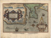
https://hdl.handle.net/10316.2/43414| Title: | Zee carte van Portugal, daer inno begreven de vermaerde Coop stadt van Lisbone S:Vues met hare Riuieren Soe hem die selfde Landen verthoonen alsmen de Riuieren op eñ off zeijlt | Other Titles: | Chartae maritimae Portugalliae, et celebris Empory Lisbonae S. Ubalis, et fluviorum descriptio, veraque facies horum regionum, cum secundo et adverso fluctu navigantur fluvii | Keywords: | Portugal;Costa | Issue Date: | 1590 | Publisher: | [Cornelis Claesz] | Description: | Retirado de "Spiegel der Zeevaerdt". No verso, texto intitulado "Description de la plus renommee partie de Portugal. depuis les Barlengas jusques oultre Sainct Vues". Canto inferior direito inscrito o número 17. Mapa bastante ornamentado, apresenta duas cartelas um monstro marinho e embarcações da época. Na margem superior apresenta vista da linha de costa. Escala gráfica: 4 Spaensche Mÿlen tot 17 1/2 in een graedt ; 4 Duÿtsche Mÿlen tot 15 in een graedt. |
URI: | https://hdl.handle.net/10316.2/43414 | Rights: | open access |
| Appears in Collections: | Cartografia |
Files in This Item:
| File | Description | Size | Format | |
|---|---|---|---|---|
| UCBG-NC-0740_0001_1_t0.tif | 406.77 MB | TIFF |  |
This item is licensed under a Creative Commons License

